The walk across the salt marsh from Crag Foot to Jenny Brown's Point is one of my favourites. And like nearly every other walker I meet, I'm intrigued by its name: Quaker's Stang. It begs the immediate questions: who was this Quaker...and what in the name of Jenny Brown is a stang?
I might as well admit from the start: I don't actually know what Quaker's Stang means. But that's not going to stop me theorising! Like many others I have trawled the internet in search of a direct translation. A stang, it seems can be a unit of measurement... same as a perch, apparently, or about five and a half yards in modern currency. It might also mean a pole. It's tempting to picture a seventeenth century Quaker making a perilous crossing of the foreshore equipped with his trusty pole ... or perhaps he (or she) planted one or more strategic waymark poles on the sands to assist travellers.
But I suspect this attempt at literal translation misses the point. On the modern Ordnance Survey map Quaker's Stang is associated directly with the sea-defences that cross the entrance to Leighton Moss. We talk about walking on Quaker's Stang.

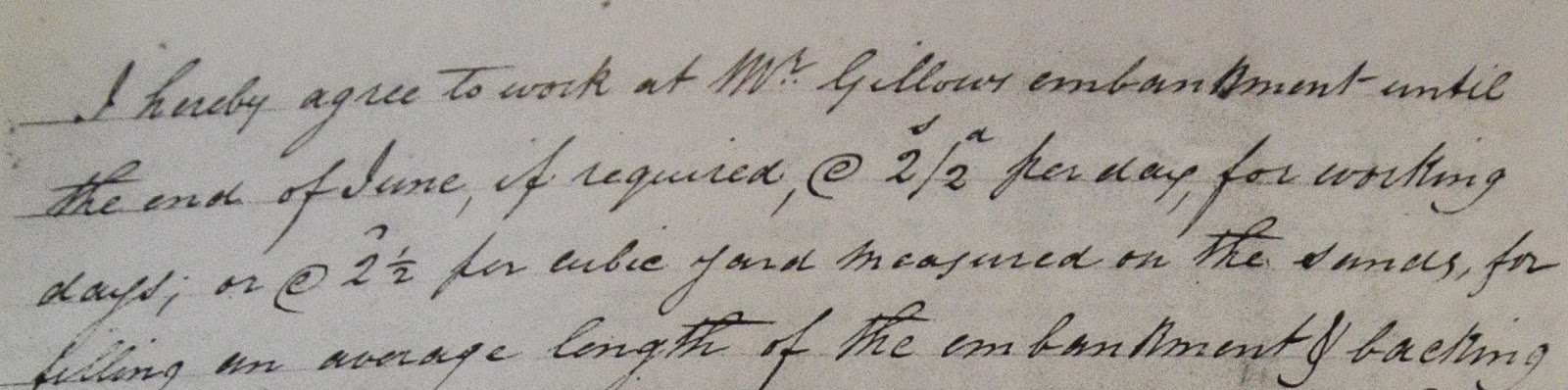
This embankment -- with its sluice gate on the Lindeth side and fine limestone facings -- was the work in 1840 of Richard Thomas Gillow. Or more accurately, it was the work of about 20 local men employed by Squire Gillow at 2 shillings and eightpence a day. (Squire Gillow offered them 2/2d a day but they held out for the extra sixpence!)
My suspicion is that names have become a little confused over the years. Looking at Greenwood's map of Lancashire from 1818 -- more than 20 years before the Squire commissioned his sea embankment -- there is a Quaker's Stang clearly marked. But it seems to be referring to the stream that drains the Moss: the stream that today we call Quicksand Pool.
 |
| Greenwood's Map of Lancashire from 1818 |
And here we come to a point raised by Rod Ireland, one of the excellent lecturers at the AONB Trust's Landscape History weekend earlier this month. Might Quaker's Stang, Rod suggested, be a corruption of the much older name Quicksand Pool? In a thirteenth century Warton Manorial Charter the name of the stream draining the Moss is written -- in Latin -- as "Quytsandpole". Perhaps by 1818, repetition, mishearing and mis-transcription had modified this to Quaker's Stang. At some point post-1840 the label transferred from the stream to Squire Gillow's new embankment. And just to add to this confusing morass, the old Quicksand Pool name itself survives on modern maps as the name for the stream. I feel the waters closing over my head. Quick someone, pass me a stang!